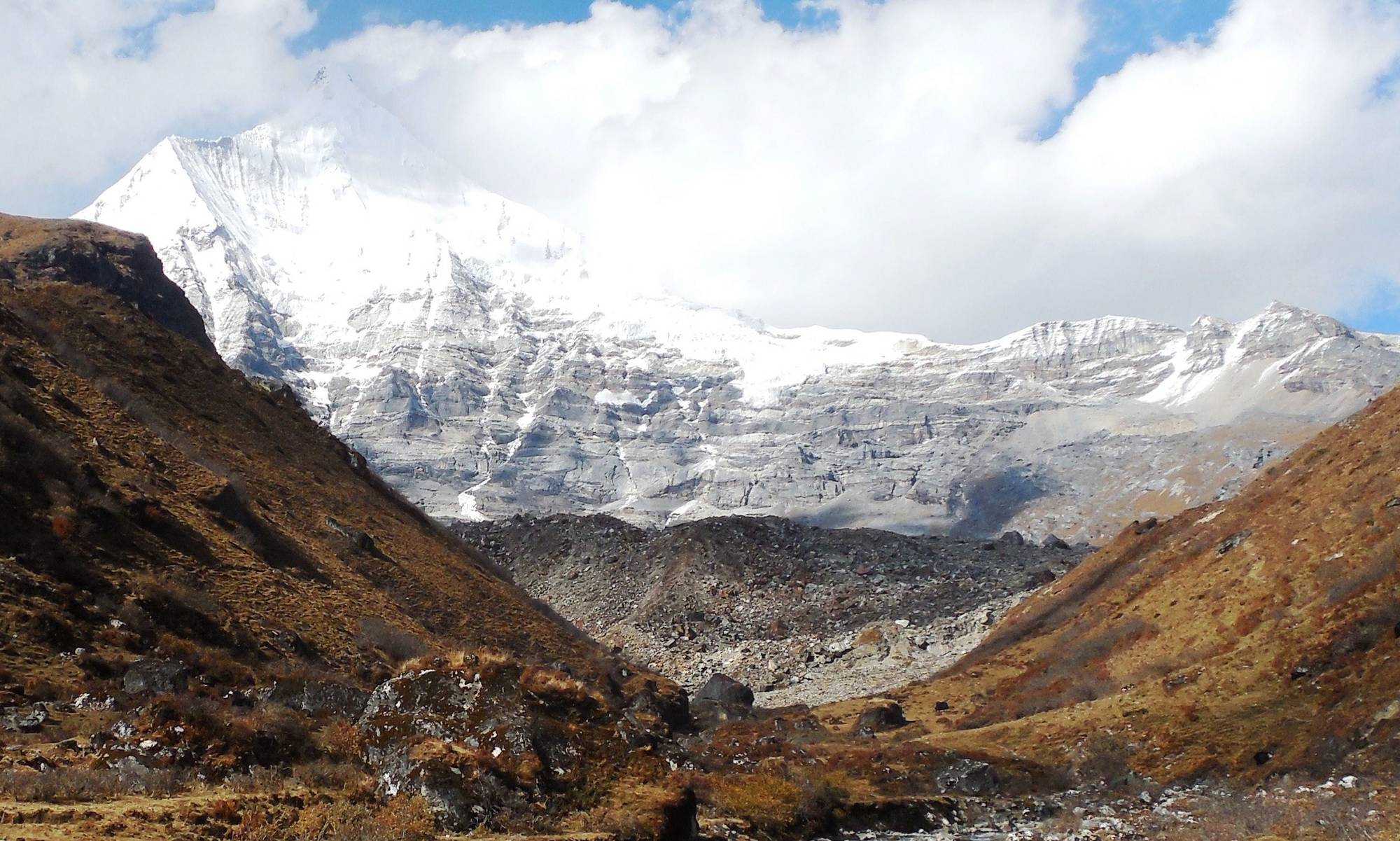
North-west Bhutan · Strenuous
Laya–Gasa
Jomolhari, four high passes, two nights in Laya village and a soak at Gasa to finish.
- Days
- 1716 nights
- On trek
- 12 days12 nights camping
- Distance
- 166 kmon foot
- Highest
- 5,005 mSinche La
- Best months
- Spring, autumnApril and May, late September and October
- From
- USD 5,890per person, all fees in
Photo: Steve Pastor, CC BY 3.0
Overview
Laya–Gasa: Jomolhari to the hot springs
The Laya–Gasa trek takes the Jomolhari route to Lingshi, then keeps going north through Jigme Dorji National Park: four passes, the highest Sinche La at 5,005 m, and some of the wildest country in Bhutan.
You spend two nights in Laya, a highland village at 3,840 m where Layap women still wear conical bamboo hats, then walk down the Mo Chhu valley to Gasa and its hot springs. Twelve trekking days and about 166 km.
Is it for you? Strenuous
Strong and experienced: twelve days of camping, several 7 to 8 hour days and a 5,000 m pass. You should have trekked above 4,500 m before.
Highlights
- Sinche La (5,005 m), the highest point, with Gangchhenta above
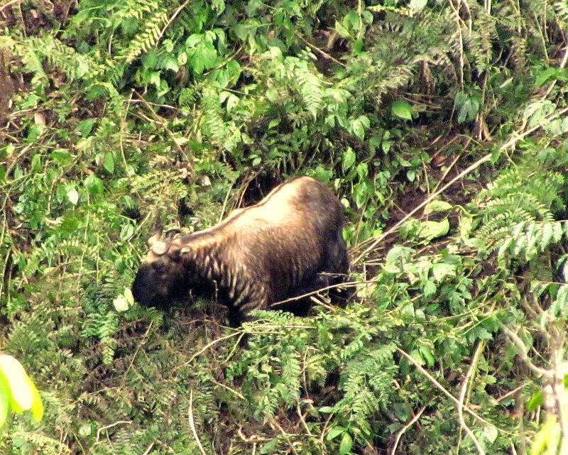
- Takin and blue sheep country between Shomuthang and Robluthang
- A rest day in Laya village
- Finish in the Gasa hot springs
“Laya village was the best part of my trip. We stayed two nights, so we could visit a family's house and drink butter tea together. Everyone was very kind to us. After twelve days of walking, the hot spring at Gasa was wonderful, like onsen in Japan. I was a little sad when the trek finished. Thank you very much to Tshering and all the team.”
Route
Shana to Gasa
The line follows the trail as mapped in OpenStreetMap. Dashed sections are approximate, where the trail isn't mapped. Camps are green, passes orange.
The route map needs JavaScript. The stops are listed below.
- Shana 2,850 m
- Soi Thangthangkha 3,610 m
- Jangothang 4,080 m
- Nyile La 4,870 m
- Lingshi 4,010 m
- Chebisa 3,880 m
- Gobu La 4,410 m
- Shomuthang 4,220 m
- Jare La 4,750 m
- Robluthang 4,160 m
- Sinche La 5,005 m
- Limithang 4,140 m
- Laya 3,840 m
- Koina 3,050 m
- Bari La 3,740 m
- Gasa hot springs 2,200 m
Elevation profile
Day by day
The itinerary
Distances, times and heights are typical. Your guide adjusts the plan to the weather and the group.
Day1Arrive in Paro
Fly into Paro (2,200 m). Airport pick-up and a full kit check.
Night: Hotel, Paro
Day2Acclimatisation hike at Chele La3–4 h
- Walking
- 3–4 h
Drive to Chele La (3,988 m on the road sign) and walk the ridge for three to four hours.
Night: Hotel, Paro
Day3Shana to Soi Thangthangkha22 km · 7–8 h
- Distance
- 22 km
- Walking
- 7–8 h
- Up
- 770 m
- Down
- 10 m
- Sleep at
- 3,610 m
Drive to Shana (2,850 m) and walk up the Paro Chhu through forest to a meadow camp.
Night: Camp
Day4Soi Thangthangkha to Jangothang19 km · 6–7 h
- Distance
- 19 km
- Walking
- 6–7 h
- Up
- 480 m
- Sleep at
- 4,080 m
Above the treeline to Jomolhari base camp.
Night: Camp
Day5Rest day at Jangothang
- Sleep at
- 4,080 m
Acclimatise with a hike to the Tsho Phu lakes.
Night: Camp
Day6Over Nyile La to Lingshi18 km · 6–7 h
- Distance
- 18 km
- Walking
- 6–7 h
- Up
- 840 m
- Down
- 870 m
- Sleep at
- 4,010 m
Up to Nyile La (4,870 m) and down to Lingshi.
Night: Camp
Day7Lingshi to Chebisa10 km · 5–6 h
- Distance
- 10 km
- Walking
- 5–6 h
- Up
- 280 m
- Down
- 410 m
- Sleep at
- 3,880 m
A short day past stone villages to Chebisa, with a waterfall behind the houses.
Night: Camp
Day8Over Gobu La to Shomuthang17 km · 6–7 h
- Distance
- 17 km
- Walking
- 6–7 h
- Up
- 890 m
- Down
- 540 m
- Sleep at
- 4,220 m
A steep climb to Gobu La (4,410 m). Watch for blue sheep on the slopes. Camp by a stream at Shomuthang.
Night: Camp
Day9Over Jare La to Robluthang18 km · 7–8 h
- Distance
- 18 km
- Walking
- 7–8 h
- Up
- 700 m
- Down
- 760 m
- Sleep at
- 4,160 m
Over Jare La (4,750 m) and down into the valley where takin graze in summer. Camp at Robluthang.
Night: Camp
Day10Over Sinche La to Limithang19 km · 7–8 h
- Distance
- 19 km
- Walking
- 7–8 h
- Up
- 850 m
- Down
- 870 m
- Sleep at
- 4,140 m
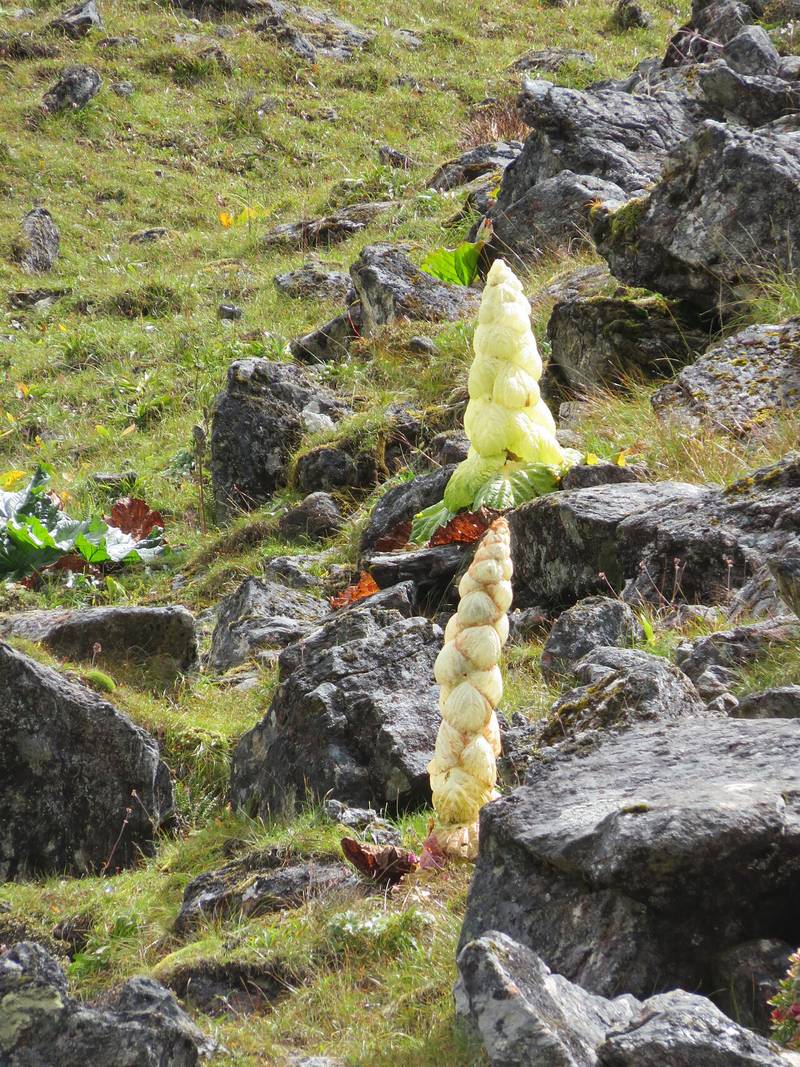
The longest and highest day: Sinche La (5,005 m), with Gangchhenta's glaciers close. Look for noble rhubarb on the descent to camp at Limithang.
Night: Camp
Day11Limithang to Laya10 km · 4–5 h
- Distance
- 10 km
- Walking
- 4–5 h
- Up
- 60 m
- Down
- 640 m
- Sleep at
- 3,840 m
Down through forest to Laya village (3,840 m). Camp at the edge of the village.
Night: Camp
Day12Rest day in Laya
- Sleep at
- 3,840 m
Walk around the village, visit a Layap home for butter tea, or just sleep. Your crew restocks here.
Night: Camp
Day13Laya to Koina19 km · 7–8 h
- Distance
- 19 km
- Walking
- 7–8 h
- Up
- 260 m
- Down
- 1,070 m
- Sleep at
- 3,050 m
Down the Mo Chhu valley over a small pass (3,300 m) to camp at Koina.
Night: Camp
Day14Over Bari La to Gasa14 km · 6–7 h
- Distance
- 14 km
- Walking
- 6–7 h
- Up
- 740 m
- Down
- 1,500 m
A last climb to Bari La (3,740 m), then down to Gasa and the hot springs. A road now reaches Koina, so in some seasons we drive this last stretch and spend the time in the pools.
Night: Camp, Gasa
Day15Gasa to Punakha
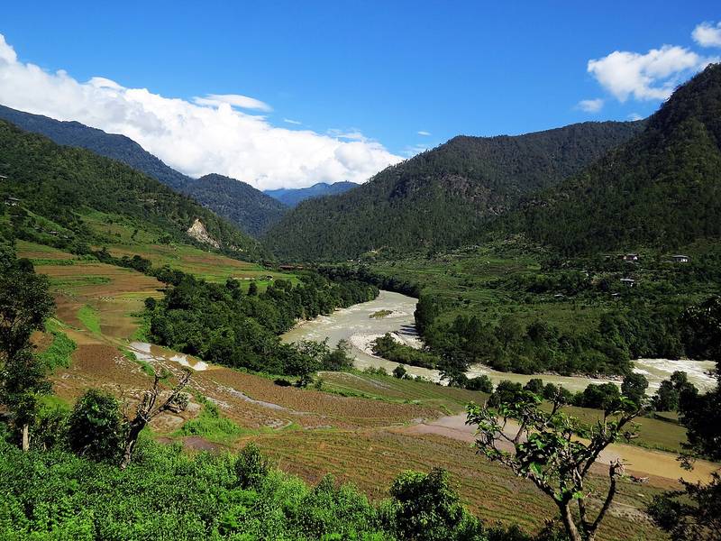
Drive 95 km down to the warm Punakha valley (1,200 m), about 3.5 hours. Rafting is a good way to spend the afternoon.
Night: Hotel, Punakha
Day16Punakha to Paro
Drive over Dochu La (3,150 m) to Paro, about 4 hours.
Night: Hotel, Paro
Day17Depart
Transfer to Paro airport for your flight out.
On the trail
Dates and prices
Set departures
Groups of 2 to 8. Every departure runs with two trekkers; “Guaranteed” means it's already confirmed. Private dates are possible for any group.
| Start | End | Price | Availability |
|---|---|---|---|
| Sat 17 Apr 2027 | Mon 3 May 2027 | USD 5,890 | Guaranteed |
| Sat 25 Sep 2027 | Mon 11 Oct 2027 | USD 5,890 | Open |
| Sat 9 Oct 2027 | Mon 25 Oct 2027 | USD 5,890 | Open |
| Sat 15 Apr 2028 | Mon 1 May 2028 | USD 5,890 | Open |
Single room and tent: add USD 40 a night. Prices are per person, twin share.
Hold a placeAdd-ons
Make it your own
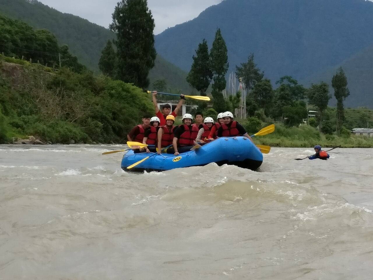
White-water rafting, Punakha
USD 90 pp
The Mo Chhu is class I to II, about two hours on the water, and needs no experience. The Pho Chhu starts with class IV rapids and eases to class III: for confident swimmers aged 14 and over (USD 120). Best March to May and September to November.
Chele La downhill by mountain bike
USD 120 pp
Swap the day 2 hike for a 35 km ride down the road from Chele La (3,988 m on the sign) to the Paro valley. Bike, helmet, bike guide and support vehicle included.
Hot stone bath in a Paro farmhouse
USD 45 pp
A wooden tub of river water heated with fire-baked stones, the traditional Bhutanese dotsho. Best on your last night, after the trek.
Sleeping bag hire
USD 40 per trip
A four-season down bag rated to -20 °C, cleaned between trips, with a cotton liner.
What's included
Everything on the mountain
Included
- A trekking guide certified by Bhutan's Department of Tourism, from arrival to departure
- Cook, kitchen crew and horsemen, with ponies (or yaks above Laya) to carry camp and bags
- All meals on trek; breakfast, lunch and dinner in town
- Two-person tents, dining and toilet tents, foam and inflatable sleeping mats
- Certified 3-star hotels in town, twin share
- Private vehicle and driver for every transfer
- Sustainable Development Fee (USD 100 a night) and your Bhutan visa (USD 40)
- National park and trekking permits, and 5% GST
- Satellite phone and full first-aid kit on every trek; portable altitude chamber on treks above 4,500 m
Not included
- International flights to and from Bhutan
- Travel insurance with helicopter evacuation cover (strongly recommended)
- Sleeping bag (hire one from us)
- Tips for the crew, drinks, laundry
- Single room and tent (USD 40 a night)
Questions
About this trek
How remote is it?
Very. After Jangothang there is no road until Koina, and no phone signal for most of the trek. We carry a satellite phone and a portable altitude chamber.
Will we see takin?
Sometimes. Bhutan's national animal summers in the valleys around Robluthang. Blue sheep and marmots are almost certain.
Can we visit during the Royal Highlander Festival?
The festival is held in Laya in October in some years. Ask us when you enquire and we'll check dates.
More on visas, the SDF, altitude and kit in Plan your trip.
Also consider
Other treks


Ready for Laya–Gasa?
Tell us which departure suits you, or ask for private dates. We reply within a day.